
Copyright: Städteregion Aachen, Dominik Ketz
Erzgrube Diepenlinchen
Stolberg
The History of the Diepenlinchen Mine
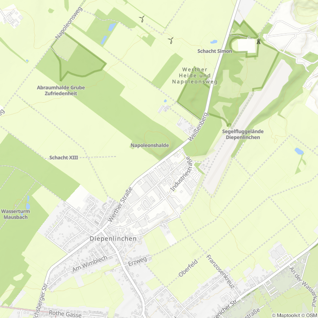
The name Diepenlinchen is derived from the local dialect term “Diepe Linche,” which translates to “deep shafts” in Standard German. In fact, the mine’s main complex has a depth of 382 m, making it more than twice as deep as the shafts of the surrounding mines. Mining began at the mine in 1809, while the region was still under French occupation. Prior to that, the Romans had already mined down to the water table, and in the 17th and 18th centuries, calamine near the surface had been extracted through open-pit mining, followed later by stoping and stoping-and-packing methods.
Due to the immense inflow of water and inadequate drainage, mining operations had to be suspended before reaching the 80-meter level. It was not until the 1840s that mining operations could be resumed after significant technical and financial effort by the new owners, namely the “Metallurgische Gesellschaft zu Stolberg” (76.6% stake) and the “Eschweiler Bergwerksverein” (23.4%), were operations finally able to resume. In addition to many other operational points, the mine was operated via the following shafts: Main hoisting shaft, 356 m deep; transport shaft, 350 m deep; Wittmann shaft (water drainage), 382 m deep; Blum shaft (water drainage), 382 m deep; and Frosch shaft (ventilation shaft). Over the years, mining in the mine continued at ever-greater depths below the “Alter Mann”—the surface area that had been completely churned up by pre-industrial mining—starting at a depth of 67 m.
The mine was shut down in 1919, officially due to a strike by the miners, but in reality because of the costs of dewatering. Above ground, however, processing of the old tailings piles continued until 1942. To extract the ore still remaining in the tailings piles, the tailings were finely ground using the flotation process and mixed with water to form a slurry.
By injecting air, the process took advantage of the physical differences between the ores and the waste rock. Since the ores have different surface wettability than the waste rock, the ore particles adhere to the air bubbles and can be skimmed off the surface as ore-rich foam. The particles of the surrounding rock, however, sink to the bottom. What remains is a fine mixture of sand and clay, which is dumped into a tailings pile. You can still clearly see this tailings pile above the glider airfield. However, most of it has been covered and planted to prevent it from being blown away.
(Text: Jens Mieckley)
This route was developed as part of the LEADER-funded project “Quality Initiative for Hiking in Roetgen and Stolberg” with support from the European Union (EAFRD) and the state of North Rhine-Westphalia.
Impressions

Contact
Montanhistorischer Rundweg
52224 Stolberg


